Dr. Pete Dailey discusses rapid intensification in tropical cyclones and its role in increasing their propensity to cause damage at landfall.
Applicability ■■■■
Materiality ■■■■■
Action Required ■■
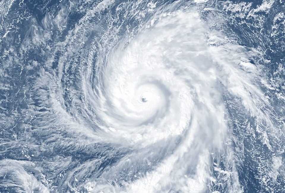
The Atlantic hurricane season is characterized by the development of tropical cyclones (TCs) from their early stage as weak tropical depressions, to mature hurricanes with winds and storm surge that can cause widespread and often catastrophic damage. The intensification cycle, which can take a weak TC to hurricane intensity, is a complex process involving the warmth of the ocean surface, the depth of that warm water, the humidity of the air above the ocean surface as well as various impediments to development such as wind shear and airborne dust from the Saharan Desert.
When a hurricane develops under “optimal conditions” – that is, a very warm ocean with high atmospheric humidity, etc. – it not only organizes itself into an efficient heat engine, but it also develops a resilient eyewall at its center. Within that eyewall are the hurricane’s strongest winds, and, when conditions are highly favorable for development, the pressure in the center of the storm drops as wind speeds in the eyewall climb.

Figure 1 – Hurricane intensification is an uphill battle. While under optimal conditions, warm SSTs can bring a hurricane up the Saffir-Simpson scale in wind intensity, inevitably natural impediments – such as wind shear and dry air – subdue the winds and break apart the hurricane until it ultimately weakens and dissipates. For this reason, CAT5 hurricanes are rare and short-lived, typically dropping below CAT5 strength in less than 24 hours.
However, as a hurricane strengthens, it becomes more susceptible to adverse conditions and more difficult for the storm to intensify further. Using the analogy of a ball sitting atop a ramp (Figure 1), a warm ocean may fuel a hurricane’s journey up to peak intensity, but over time impediments like wind shear, dust, dry air and eyewall replacement inevitably force hurricanes back down to lower intensity, eventually leading to dissipation. For these reasons, the technical process of what is referred to as Rapid Intensification is relatively infrequent, occurring on average about once per season, given the need for optimal conditions that are generally rare and unsustainable. The typical CAT5 Atlantic hurricane lasts less than 24 hours and no hurricane on record has maintained CAT5 strength for more than a few days.
Considering what’s at stake, understanding exactly how a hurricane converts the heat of the ocean into wind energy and how some storms can overcome multiple impediments along their path are fertile areas of scientific research since hurricane winds are a dominant source of loss in natural catastrophes worldwide.
Defining the Rapid Intensification Cycle (RIC)
The Saffir-Simpson scale is conventionally used to rate the intensity of Atlantic hurricanes.
TCs first develop as ‘depressions’ with 30 – 40 mph winds. When winds reach 40 mph, TCs are officially named as tropical storms. If winds further intensify to 74 mph, they are declared a hurricane. The Saffir-Simpson scale rates hurricanes across five categories of increasing wind speed, from CAT1 with winds of up to 95 mph, to the rarest and most intense CAT5 with winds exceeding 156 mph. CAT1 and CAT2 are considered ‘minor’ and CAT3, CAT4 and CAT5 are considered ‘major’ hurricanes. Damage potential exponentially increases with wind speed, thus making major hurricanes that impact land the primary cause of TC loss.

Figure 2 – The Saffir-Simpson Hurricane Wind Scale is a conventional measure of hurricane wind intensity. Category 1-2 hurricanes with winds of between 74 and 110 mph, despite being ‘minor’ hurricanes, can cause extensive damage. Major hurricanes of categories 3-5 pack winds over 110 mph and those making landfall cause widespread and often catastrophic damage.
But are all major hurricanes created equal? As one digs a bit deeper, it becomes clear that the route to major hurricane status varies greatly from one TC to the next, with a key difference being the rate at which major hurricane intensity is achieved. This matters most when a hurricane has limited distance and/or time before it reaches land or encounters conditions upstream in its track that impede development.
To objectively measure the rate at which the most severe TC intensification occurs, meteorologists have defined the concept of Rapid Intensification (“RI”) as an increase in wind speed of 35 mph or more over a period of 24 hours. The time period over which a TC experiences this high rate of intensification is called a Rapid Intensification Cycle (“RIC”).
Why Do RICs Matter?
Rapid intensification is key to understanding the propensity of hurricanes to cause damage. For example, the difference in damage potential between a tropical storm with 45 mph winds and a CAT1 hurricane with 90 mph winds is not 2x (as the increase in winds imply), but between 10x and 20x due to the exponential relationship between wind speed and building vulnerability. In turn, the intensification of a CAT1 to a major hurricane could also increase potential damage by 10x or more. When the intensity spikes in a day or less, it can lead to uncertainty and unpreparedness if the hurricane is close to making landfall.
Since, by definition, an RIC increases winds by 35 mph or more, any RIC episode creates a dramatically higher scenario for loss at landfall. For example, as shown in Figure 3, an RIC in a CAT1 hurricane means that one day later it has become a CAT3 major hurricane, and a strong CAT3 experiencing rapid intensification will emerge as an extremely dangerous CAT5.

Figure 3 – A cycle of Rapid Intensification generally increases a hurricane’s intensity by two Saffir-Simpson categories, and in turn exponentially increases the damage potential if the hurricane strikes land, often by 10-fold or more.
RI is nothing new. In the Atlantic, there are 100+ documented historical examples of RI across the full intensity spectrum. Some examples are shown in Figure 4. In 1981, Hurricane Harvey strengthened from a rather ragged tropical depression with 35 mph winds to a CAT1 hurricane, all in less than 12 hours. In 2005, Tropical Storm Wilma became CAT5 Major Hurricane Wilma in a remarkable 24 hours, increasing wind speeds by 105 mph and moving one category up the Saffir-Simpson scale every few hours during the cycle. Though it took a bit longer, Hurricane Felix (2007) intensified by 140 mph to become one of the most intense Atlantic hurricanes on record, taking it across the entire spectrum from tropical depression to CAT5 over multiple RICs in just over two days.

Figure 4 – Examples of historical RICs include Harvey (1981) which moved from TD to CAT1, Wilma (2005) which moved from Tropical Storm to CAT5, Felix (2007) which moved from TD to CAT5, Ida (2021) which moved from CAT1 to CAT4 on its approach to the Gulf Coast and Ian (2022) which moved from CAT3 to CAT5 just prior to its landfall along Florida’s west coast. In all cases, the RIC has drastically increased the risk of catastrophic loss.
More recently, Hurricanes Ida (2021) and Ian (2022) experienced rapid intensification on their route to the Gulf coast, owing to the deep warm waters of the Loop Current, which is resident to the Gulf of Mexico, and has been responsible for a number of notable strikes on the Gulf region including hurricanes Katrina (2005), Rita (2005), Wilma (2005), Harvey (2017) and Michael (2018) (Aeolus InSight on the Loop Current). When storms experience RICs and go on to make landfall, the damage footprint is much larger and more severe, and recovery time is much lengthier. Economic and insured losses are compounded by other factors related to intense winds, including coastal storm surge and damage from flying debris.
Are RICs Predictable?
In the short-term and on an event-by-event basis, RICs are only somewhat predictable. The National Hurricane Center (NHC) has developed a number of metrics used to forecast the likelihood of a RIC, based largely on the local atmospheric and oceanic conditions; namely sea-surface temperatures, air humidity, and the presence of wind shear. However, because research has shown that RICs are a complex function of these external factors, as well as the internal dynamics of the hurricane ‘engine’ itself, forecasters have had limited success in their predictions. Beyond a few days, RIC forecasts are marginal at best.
In the longer-term, with an eye on climate change and the likelihood that the Atlantic Ocean will remain warmer than the average since 1900, scientists expect an increased supply of ocean heat content for hurricanes to develop and intensify. In turn, there is little reason to doubt that RICs will increase accordingly. Numerical models, used to simulate the future climate, are in general agreement that RICs will become more frequent in a warming world. This finding supports the consensus of the IPCC (Climate Change Research Series: Part 1), that while the frequency of global TCs may remain stable in the future climate, the proportion of storms that achieve major hurricane status will increase.
Observational evidence is perhaps most convincing. As shown in Figure 5, rapid intensification often precedes landfall in hurricanes affecting the U.S. coastline. Along the Gulf coast over the period since 1900, landfalling hurricanes that have undergone rapid intensification occur roughly every other year (frequency = 0.59 per year), while along the Southeast coast, the frequency is considerably less (frequency = 0.22 per year). However, under warmer-than-average Atlantic conditions, the rate of RIC prior to landfall increases by 45% in the Gulf and 30% in the Southeast, with Florida receiving about half of those higher intensity events.
The analysis points to increasing risk across the U.S. coastline as ocean temperatures warm, but specifically highlights the susceptibility to hurricanes born in, or entering, the Gulf of Mexico under optimal development conditions. In the absence of an RIC, Gulf hurricanes have limited time and short distance to intensify before tracking over land and losing their ocean-based fuel supply. Thus, Gulf landfalls for “ordinary” hurricanes will have much less destructive power without the intensity boost of an RIC. The most catastrophic Gulf landfalls are well-known for having previously intensified rapidly, often over the deep warm waters of the Loop Current. In addition, because the Gulf of Mexico is a 90% ‘trapped’ domain, a hurricane entering into or developing within the Gulf is not likely to exit without making landfall. As a result, RIC landfalls are 3x more likely along the Gulf coast compared to the Southeast coast under warm ocean conditions, on average occurring about once per season (frequency = 0.86 per year).
Florida is particularly susceptible to RIC events since the state receives almost half of RIC-preceded landfalls on both sides of the peninsula. In warm years, there appears to be a slight uptick in RIC landfalls on Florida’s West coast (+4%) and a slight reduction on Florida’s East coast (-4%). This shift may be due to changes in how and where hurricanes track over an anomalously warm ocean. Aeolus Research continues to study this and other subtle changes in the risk profile of landfalling hurricanes.

Figure 5 – RICs are increasing in frequency across the Atlantic basin. RICs are highlighted with colored track segments, warmer colors indicating higher wind intensity. Both landfall regions are experiencing more RICs in warmer-than-average seasons. The Gulf coast is particularly susceptible given the short distance and reduced time hurricanes have to strengthen within the closed Gulf of Mexico domain.
Implications for Aeolus
While predicting RICs on an event basis is an ongoing challenge, changes in the long-term frequency of rapid intensification for landfalling hurricanes can help better quantify, price and manage the risks. To the extent recent history is a guide, we can leverage knowledge of the regional profile of RIC events, and in particular the contrast between the Gulf and Southeast regions, to better measure rate and intensity of U.S. hurricane landfalls. In addition, using powerful catastrophe models that account for exposed properties and their vulnerabilities to wind, we can test the sensitivity of RICs to the full development life-cycle of tropical cyclones, from genesis, to maturity, to landfall and dissipation.
Aeolus Research is actively partnered with the research community (Aeolus and SUNY Albany Announce Research Collaboration Aimed at Innovating Hurricane Prediction | Aeolus Capital Management) to explore this and other aspects of hurricane intensification and tracking. The goal is to develop innovative and differentiated approaches to quantifying hurricane risk and obtain a deeper understanding of the future implications of climate change.
The Aeolus-proprietary view of Atlantic hurricane risk explicitly incorporates RIC research, along with a diverse program of climate-related research and development. To learn more, please contact a member of the Business Development and Investor Relations team.
DISCLAIMER
THE INFORMATION CONTAINED IN THIS PAPER (THE “INFORMATION”) IS BEING FURNISHED TO RECIPIENTS ON A CONFIDENTIAL BASIS BY AEOLUS CAPITAL MANAGEMENT LTD. (“AEOLUS”) FOR DISCUSSION PURPOSES ONLY AND MAY NOT BE USED FOR ANY OTHER PURPOSE. THIS INFORMATION MAY NOT BE COPIED, RECORDED OR REPRODUCED OR OTHERWISE PROVIDED TO THIRD PARTIES IN WHOLE OR IN PART WITHOUT AEOLUS’ PRIOR WRITTEN CONSENT.
THIS PAPER CONTAINS INFORMATION REGARDING AEOLUS AND ITS AFFILIATES’ VIEWS ON VARIOUS UNCERTAIN SCIENTIFIC CONCEPTS AND CONTENT. RECIPIENTS AND THEIR ADVISORS SHOULD PERFORM THEIR OWN INDEPENDENT REVIEW WITH RESPECT TO SUCH MATTERS AND REACH THEIR OWN INDEPENDENT CONCLUSIONS.
WHILE EFFORT AND CARE HAS BEEN TAKEN IN PREPARING THE CONTENT OF THIS PAPER, AEOLUS AND THE AUTHORS DISCLAIM ALL WARRANTIES, EXPRESSED OR IMPLIED, AS TO THE ACCURACY OF THE INFORMATION SET OUT HEREIN. FURTHER, NEITHER AEOLUS NOR THE AUTHORS SHALL BE LIABLE FOR ANY LOSSES OR DAMAGES ARISING FROM THE USE OF, OR RELIANCE ON THE INFORMATION OR THE REFERENCES SET OUT HEREIN.
PORTIONS OF THE INFORMATION HAVE BEEN OBTAINED FROM THIRD PARTY SOURCES. WHILE SUCH INFORMATION IS BELIEVED TO BE RELIABLE BY AEOLUS AND THE AUTHORS, NO EXPRESS OR IMPLIED WARRANTY, REPRESENTATION OR GUARANTEE IS MADE AS TO THE CORRECTNESS, COMPLETENESS OR SUFFICIENCY OF SUCH THIRD PARTY INFORMATION. WHERE A THIRD PARTY RESOURCE HAS BEEN REFERENCED, AEOLUS SEEKS TO ACCURATELY CITE SUCH RESOURCE. NO CONTENT WITHIN THIS PAPER IS KNOWINGLY AN INFRINGEMENT OF COPYRIGHT. ANY POTENTIAL INFRINGEMENT CAN BE IMMEDIATELY ADDRESSED AND WHERE APPROPRIATE RECTIFIED, ON NOTIFICATION TO AEOLUS.
THIS PAPER CONTAINS THE CURRENT OPINIONS OF AEOLUS AND SUCH OPINIONS ARE SUBJECT TO CHANGE WITHOUT NOTICE. AEOLUS TAKES NO RESPONSIBILITY FOR UPDATING THE INFORMATION CONTAINED HEREIN AS FACTS OR AEOLUS’ VIEWS DEVELOP IN FUTURE. STATEMENTS IN THIS PAPER ARE MADE AS OF THE DATE OF THE INITIAL COMMUNICATION AND THERE SHALL BE NO IMPLICATION THAT THE INFORMATION IS CORRECT AS OF ANY TIME SUBSEQUENT TO SUCH DATE.
THE INFORMATION CONTAINED IN THIS PAPER IS NON-PUBLIC, CONFIDENTIAL AND PROPRIETARY IN NATURE. BY YOUR ACCEPTANCE OF THIS PAPER, YOU AGREE TO TREAT THE CONTENTS AS CONFIDENTIAL AND NOT TO USE IT IN ANY WAY DIRECTLY OR INDIRECTLY DETRIMENTAL TO AEOLUS.